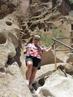

We spent about 3 1/2 hours hiking in Bandelier...about 5 miles total, so between this and the mountains the day before we were pretty beat. Not as young as we used to be, as they say!


We 1st set out on the Falls Trail. If we had gone all the way down it would have actually taken us to the Rio Grande, but we decided on a shorter 3 mile round trip to the 1st waterfall...the waterfall is actually an 80 foot drop, but it doesn't look it from here. Check out the video!


Once we got back from the falls, we headed out to the Main Loop, which this paperwork says is an hour hike...but the meant one hour each way! The walk itself was much flatter than the Falls Trail, but as you will see at the end we had us some climbing to do!

This area is a National Monument because of the ruins uncovered years ago that were once the homes of the Pueblo people. These people actually not only built homes on the ground like us, but they lived in caves in the sides of the mountains and had 2-3 story homes there. I have attached the writing here because I know some people, like Ellen, like to read about it. Number 4 talks about their religious life, while 6 talks about their homes. 7 shows what the "town" would have looked like.


There goes Cathy! I deleted my picture by mistake, but you will see more of me later! haha


Watch your step, young lady!
Where you see the holes in the mountain would have been where the roof of their dwelling was. They had wood beams jut out from there, and then potentially another story above that, or more.


These pictures show carvings in the rocks, called petroglyphs. The 1st one is just a few circles, but the next one shows what I am pretty sure to be a fish.


This is a bit more elaborate.


Now we are getting to the serious part of the trek. To get to this Alcove House, you have to climb a series of 4, very steep, ladders. going up 140 ft.. It was a little unnerving to say the least. Several spots had warnings for people to read, but I figure I am trying not to leave anything for the "bucket list", so I gave it a try.


To the right of Cathy is the 1st ladder.


For your viewing pleasure, see the videos.
This should give you a good idea of how steep this climb was.


This is at the top of the climb, with the picture showing what it would have looked like years ago. The circle on the right side of the 1st picture is actually the entrance into an underground room.
This should give you a good idea of how steep this climb was.


This is at the top of the climb, with the picture showing what it would have looked like years ago. The circle on the right side of the 1st picture is actually the entrance into an underground room.


I look at your post and think of things I wanna say throughout, then I get to the end and forget half of it.
ReplyDeleteGee, you'd think those 3 rocks you had to walk across were above a thousand foot gorge. The water is only like 2 inches deep isn't it? LOL.
OK, does Cathy have a clip to hold those keys or are they just sticking in her pocket? That would totally suck to lose the keys on one of those hikes.
The caves and buildings are pretty cool. I would really like to see those as well. Altho, not sure I could do the ladders - not so much because of the climb up as the climb down. Oh and good thing I have a laptop so I could turn it sideways to view the video of Cathy. :D.
The view is great from your RV park. Are there many RV's there? How cool would it be to wake up to that snow capped mountain view every day?
We didn't want to get wet...The keys are to keep the bears away (haha)...I screwed up the video of Cathy...not many RVs here, I just don't like the one smack-dab in front of me blocking my otherwise perfect view.
ReplyDeleteGreat Photos! Looks like an awesome place, wish I was there :(
ReplyDeleteall I can say is ya'll should have some really strong legs when you get finished with this trip. please be careful and don't break anything. mom
ReplyDelete